|
OBERKALBACH, HESSEN, GERMANY
Village of My Berthold and Ullrich Ancestors INCLUDES INFORMATION ABOUT SURROUNDING VILLAGES Origin and Description Before 1871, Germany was not one united country. The area that we now call Germany consisted of numerous kingdoms, duchies, states, electorates, free cities, municipalities, etc. During the Middle Ages, much of central Europe was organized into a loose confederation, which was called the Holy Roman Empire. Borders were constantly changing. By 1860, the largest of the kingdoms was Prussia, which covered about two-thirds of the territory which would become known as the Second German Empire in 1871, which lasted until 1918. During the years 1871 to 1918, Oberkalbach was located in the |
|
province of Hessen-Nassau in Prussia. Today Oberkalbach is in the state of Hessen. It was formerly in the Kreis (county) of Schluechtern. Today it is in Kreis (county) Fulda.
Because of these changes, it is difficult to determine place names in Germany according to their correct designation at the various times in history. In my genealogical records - pedigree charts and family groupsheets - Oberkalbach will always be listed as Oberkalbach, Hessen-Nassau, Prussia, Germany, even though it was only officially designated this way during the period from 1871 - 1918. This is also the way a researcher will find it listed in the Family History Library Catalog.
* * * * *
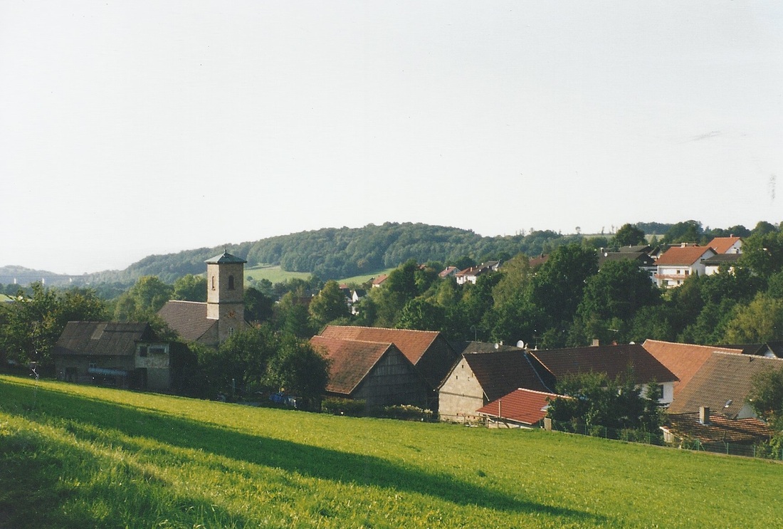
The first official mention of the village in written history was in 1167 A.D., although evidence was discovered about 1951 that the village existed as early as 826 A.D. The name by which it was first known was Kalbaha, stemming from the Celtic language, meaning "hilly slope." The settling of the area apparently began at the upper part of the slope in the east and slowly worked its way down into the valley toward the west, where originally there had been marshland and a dense forest. Typical of German villages, the houses were huddled together and the farm fields surrounded the village.
A small stream, called the Fennbach, flows parallel to the main road, which is called Am Fennbach, through the village. The Fennbach meets another small stream, the Kalbach, at the lower end of the village. The word ober means upper or above. The word bach means brook. Thus, a translation into English could be something like: Upper Sloping Hill Brook. Oberkalbach lies 385 meters above sea level. It is a Strassendorf, meaning that it is built around one main road with only a few side streets. The main road slopes down from the southeast to the northwest. In 1967, the village consisted of 3,280 acres, of which 2,080 acres were farmland and 1,065 acres were forest. Buildings, roads and unusable land comprise the remaining 135 acres. The nearest neighboring villages are Heubach, Uttrichshausen, Eichenried, Veitsteinbach and Mittelkalbach. However, for civil registration purposes, Elm, Hutten, Gundhelm and Oberkalbach were in the same district during the 18th and 19th centuries.
HOME HISTORY
Copyright 2000-2022 by Sue (Ursula Kaiser) Foster. Please contact me at for permission to copy.
I would like to know why this information is interesting to you. :-)
Because of these changes, it is difficult to determine place names in Germany according to their correct designation at the various times in history. In my genealogical records - pedigree charts and family groupsheets - Oberkalbach will always be listed as Oberkalbach, Hessen-Nassau, Prussia, Germany, even though it was only officially designated this way during the period from 1871 - 1918. This is also the way a researcher will find it listed in the Family History Library Catalog.
* * * * *
The first official mention of the village in written history was in 1167 A.D., although evidence was discovered about 1951 that the village existed as early as 826 A.D. The name by which it was first known was Kalbaha, stemming from the Celtic language, meaning "hilly slope." The settling of the area apparently began at the upper part of the slope in the east and slowly worked its way down into the valley toward the west, where originally there had been marshland and a dense forest. Typical of German villages, the houses were huddled together and the farm fields surrounded the village.
A small stream, called the Fennbach, flows parallel to the main road, which is called Am Fennbach, through the village. The Fennbach meets another small stream, the Kalbach, at the lower end of the village. The word ober means upper or above. The word bach means brook. Thus, a translation into English could be something like: Upper Sloping Hill Brook. Oberkalbach lies 385 meters above sea level. It is a Strassendorf, meaning that it is built around one main road with only a few side streets. The main road slopes down from the southeast to the northwest. In 1967, the village consisted of 3,280 acres, of which 2,080 acres were farmland and 1,065 acres were forest. Buildings, roads and unusable land comprise the remaining 135 acres. The nearest neighboring villages are Heubach, Uttrichshausen, Eichenried, Veitsteinbach and Mittelkalbach. However, for civil registration purposes, Elm, Hutten, Gundhelm and Oberkalbach were in the same district during the 18th and 19th centuries.
HOME HISTORY
Copyright 2000-2022 by Sue (Ursula Kaiser) Foster. Please contact me at for permission to copy.
I would like to know why this information is interesting to you. :-)
